Welcome to the Hydrometeorology and Remote Sensing (HyDROS) Laboratory
The HyDROS laboratory is a proud part of the University of Oklahoma (OU). We are located in the National Weather Center (NWC), Norman, Oklahoma. The HyDROS Lab is associated with the Advanced Radar Research Center (ARRC), Water Technology for Emerging Regions Center (WaTER), and the School of Civil Engineering & Environmental Science (CEES). The HyDROS Lab is a transdisciplinary research unit with synergy at the interface of remote sensing technology, water, weather, and climate. Scales of interest for modeling and prediction include the local, state, regional and global scale.
CREST Model Family

http://hydro.ou.edu/research/crest/
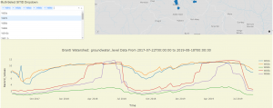
Global Streamflow Simulations for Flood & Drought Monitoring
http://hydro.ou.edu/research/crest/
Global Streamflow Simulations for Flood & Drought Monitoring
US Flash Flood Prediction System
http://flash.ou.edu
Meteorological Phenomena Identification Near the Ground
NSF PIRE

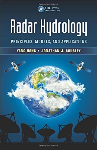
Radar Hydrology: Principles, Models, and Applications
Published:
December 23, 2014 by CRC Press
Content:
176 Pages | 13 Color & 41 B/W Illustrations
Author(s):
Yang Hong, Jonathan J. Gourley
Book Flyer:

HyDROS' Grand Challenge is to observe and predict the storage, movement, and quality of water across space-time scales by integrating advanced sensing technology and numerical predictive models into an end-to-end research and application framework.
HyDROS' Mission is to propose technological solutions for mitigating the impacts of climate change and natural hazards through interdisciplinary research and education by using the latest remote sensing technology, information technology, and hydrological models in collaboration with private and public organizations at both local and international levels for the creation of a resilient society.
We will pursue our Grand Challenge and Mission through transdisciplinary research and education involving faculty, students, and scientists with Engineering, Sciences, Math, and Socioeconomic Sciences backgrounds as well as cooperation with universities, governmental agencies, private companies/industry, and international counterparts.
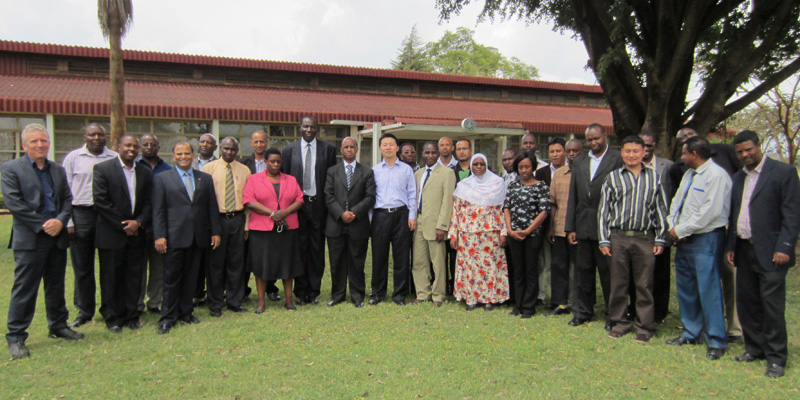
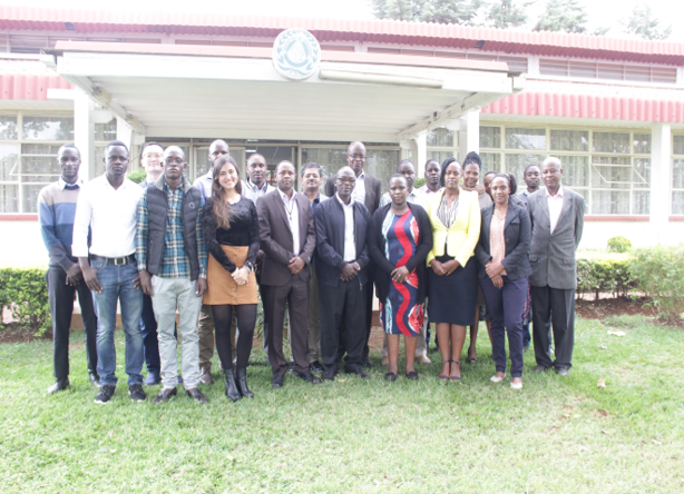
We are always looking for talented and enthusiastic students and researchers. We have advised students major in Civil Engineering, Hydrology (Water Resource Engineering), Environmental Science (Water Track), Geography, Meteorology, Computer Science and Geoinformatics. For general information on the Graduate Programs, please visit the web site of Graduate College and respective Departments for application meterials. If you wish visit HyDROS, please contact yanghong@ou.edu for more information.
HyDROS' Mission is to propose technological solutions for mitigating the impacts of climate change and natural hazards through interdisciplinary research and education by using the latest remote sensing technology, information technology, and hydrological models in collaboration with private and public organizations at both local and international levels for the creation of a resilient society.
We will pursue our Grand Challenge and Mission through transdisciplinary research and education involving faculty, students, and scientists with Engineering, Sciences, Math, and Socioeconomic Sciences backgrounds as well as cooperation with universities, governmental agencies, private companies/industry, and international counterparts.
We are always looking for talented and enthusiastic students and researchers. We have advised students major in Civil Engineering, Hydrology (Water Resource Engineering), Environmental Science (Water Track), Geography, Meteorology, Computer Science and Geoinformatics. For general information on the Graduate Programs, please visit the web site of Graduate College and respective Departments for application meterials. If you wish visit HyDROS, please contact yanghong@ou.edu for more information.